The Rhine Timber Corridor
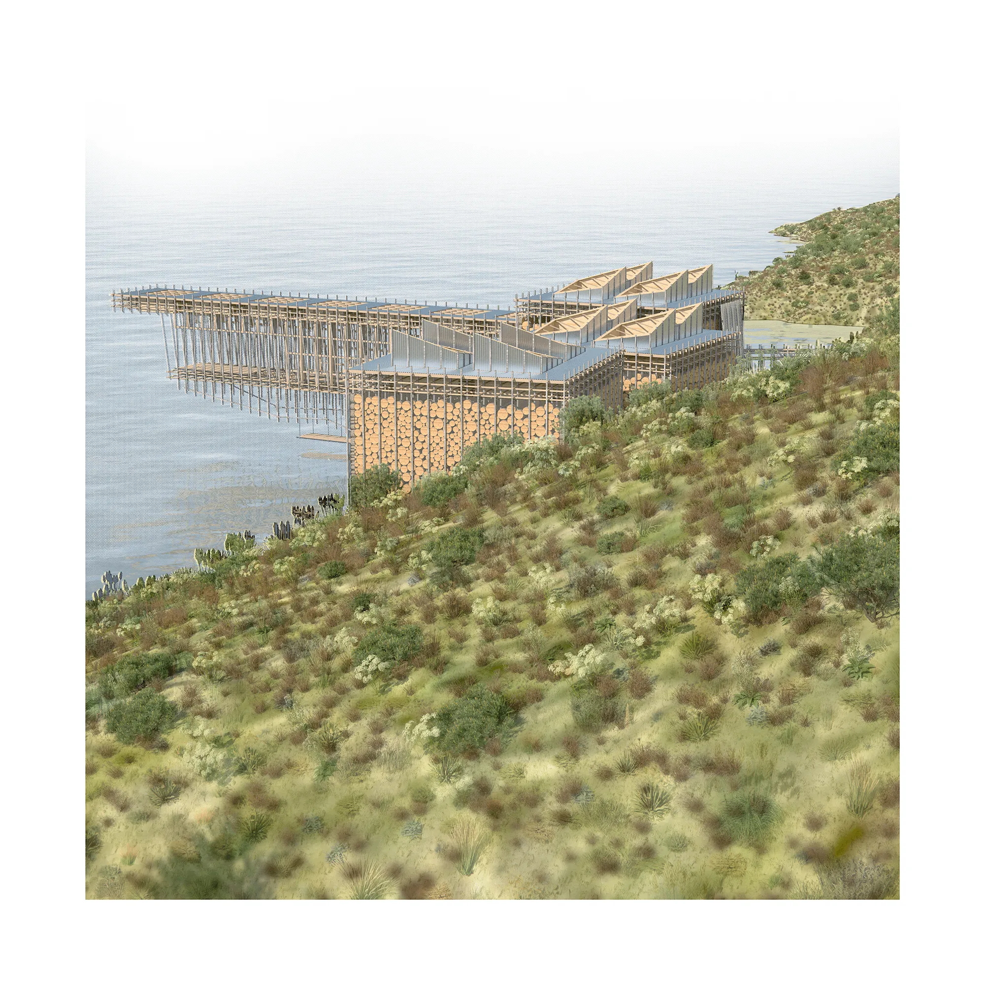
A water-powered timber mill on the Rhine, built to be repaired rather than defended, where the river both delivers the wood and periodically takes the building apart.
- Role
- Design, drawings, and site research
- Context
- Columbia GSAPP, Architecture Studio II with Abraham Murrell
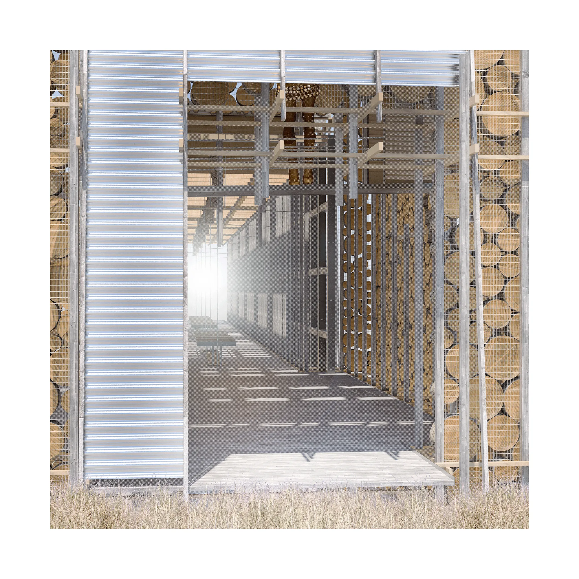
The Rhine begins as alpine melt and arrives downstream carrying whatever the mountain has shed: blowdown timber, debris, and in a bad season the contents of a glacial lake. This project takes that delivery as a given rather than a hazard, and puts a mill where the river already does the work of bringing wood down.
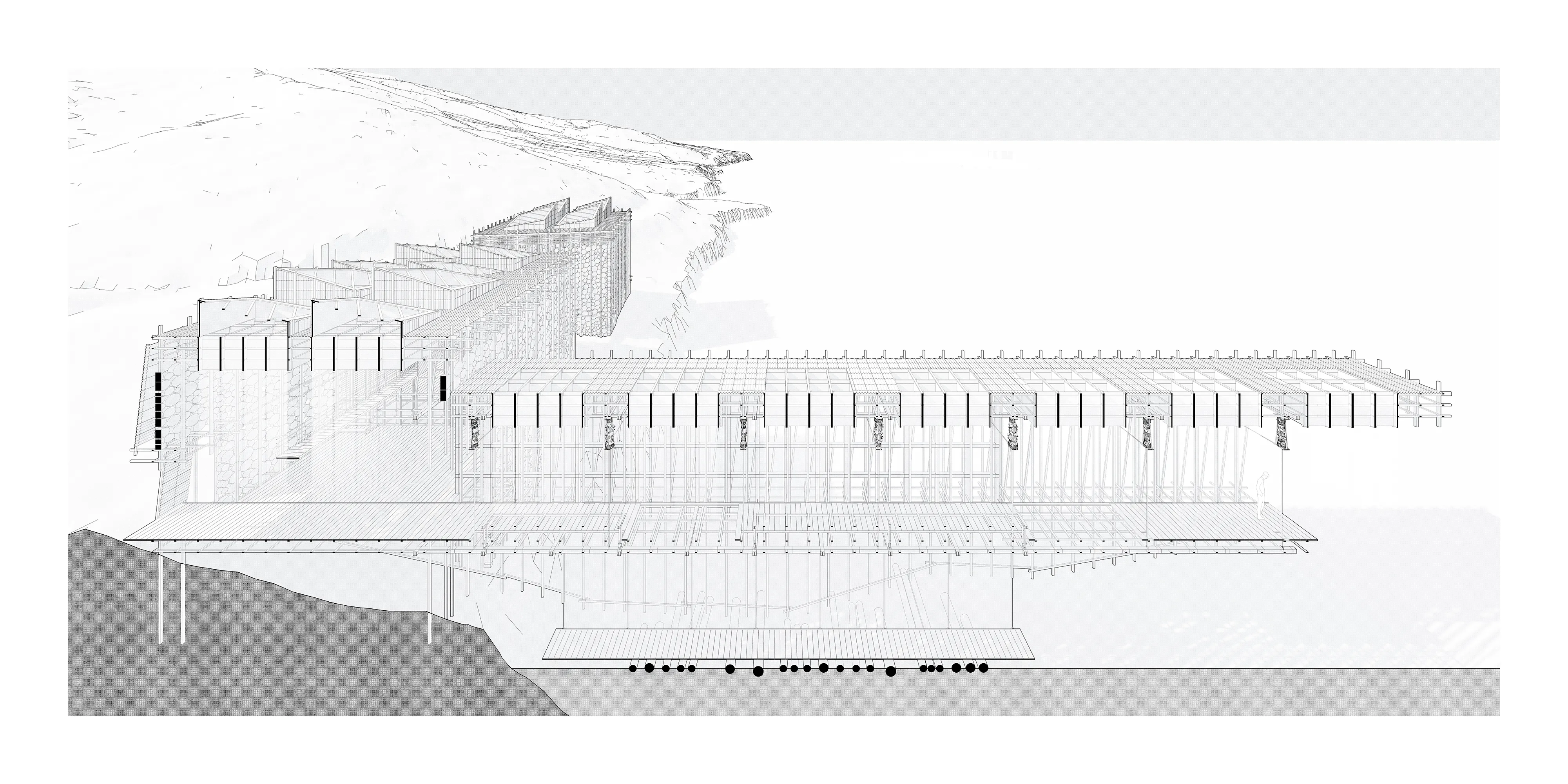
Power comes off the current. The wood is seasoned slowly on open decks rather than kiln-dried, which means the building is mostly air and racking, and means its useful volume is the part most exposed to the water. That trade is the argument: the structure earns its efficiency by accepting that it will be hit.
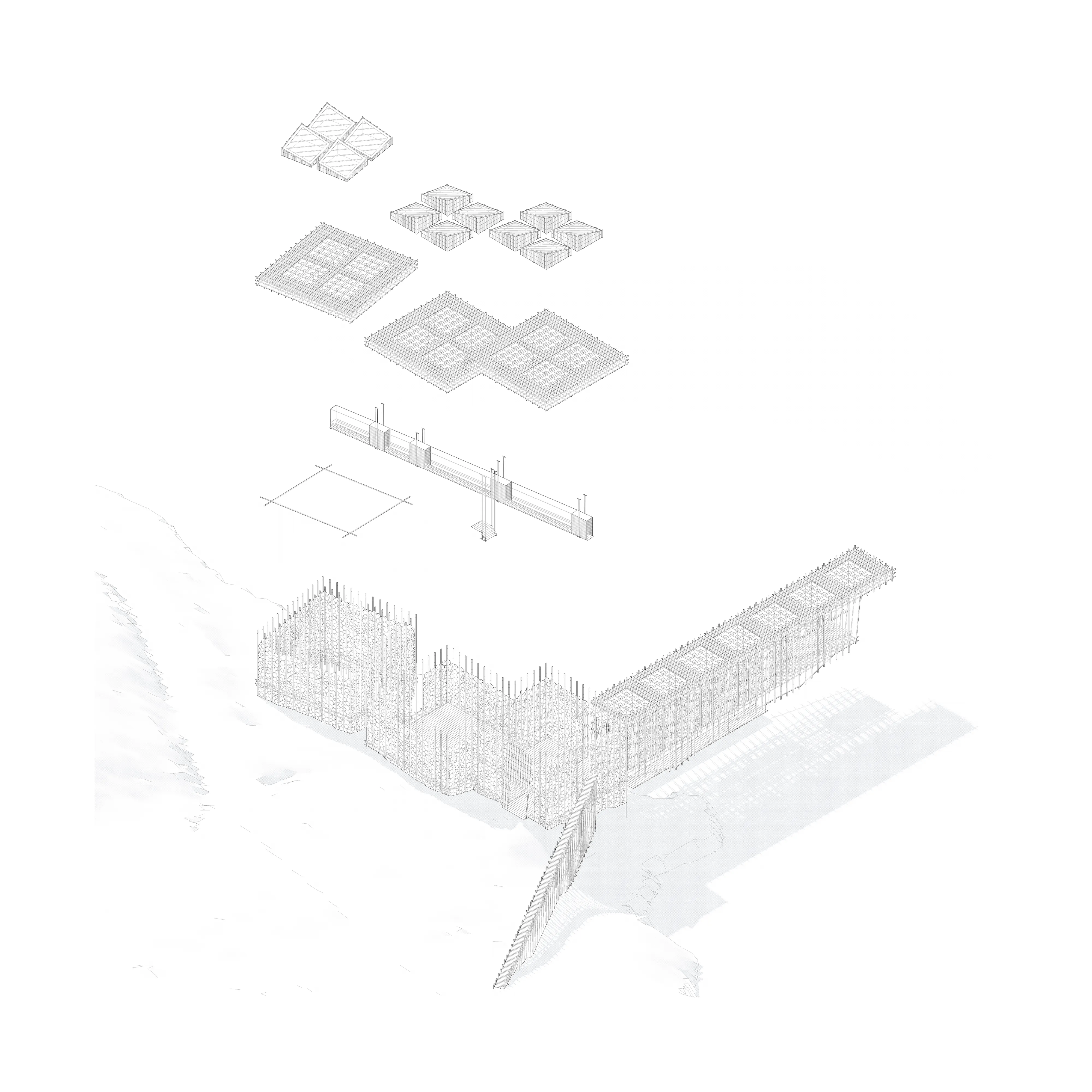
So the building is detailed in two registers. Into the hillside, gabion walls packed with offcuts and rejected logs — heavy, immobile, and made of the mill’s own waste. Over the water, inverted timber trusses and piles light enough to be replaced in a season. Nothing is designed to resist a flood outright. The building is designed to come apart in a known order and be put back together, which is how the valley has always worked.
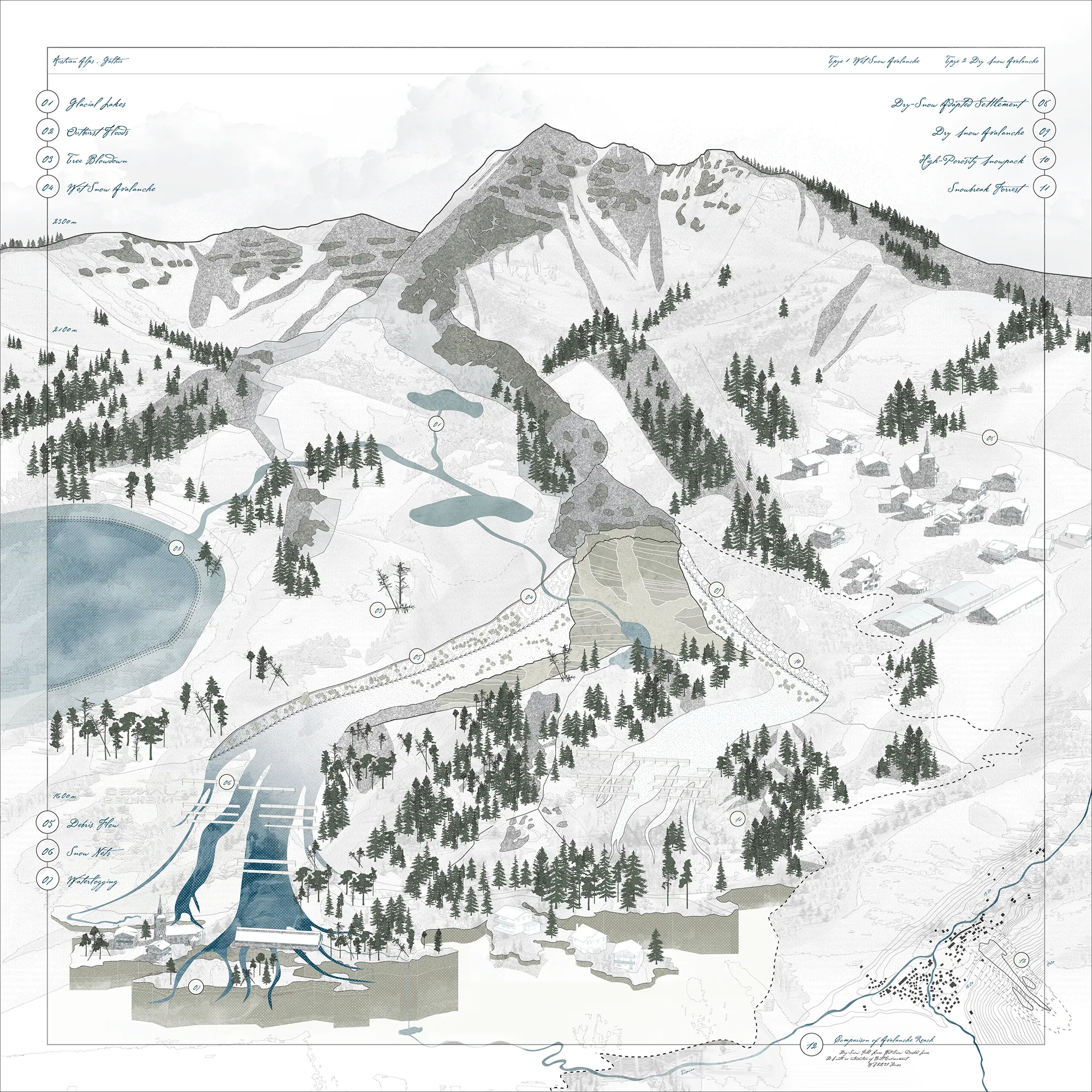
Site research at Galtür in the Austrian Alps mapped what that rhythm actually looks like: avalanche reach, debris flow, waterlogging, and the snow nets and snowbreak forest already built to manage them. The village records its floods by painting the dates on its walls.
Source documents
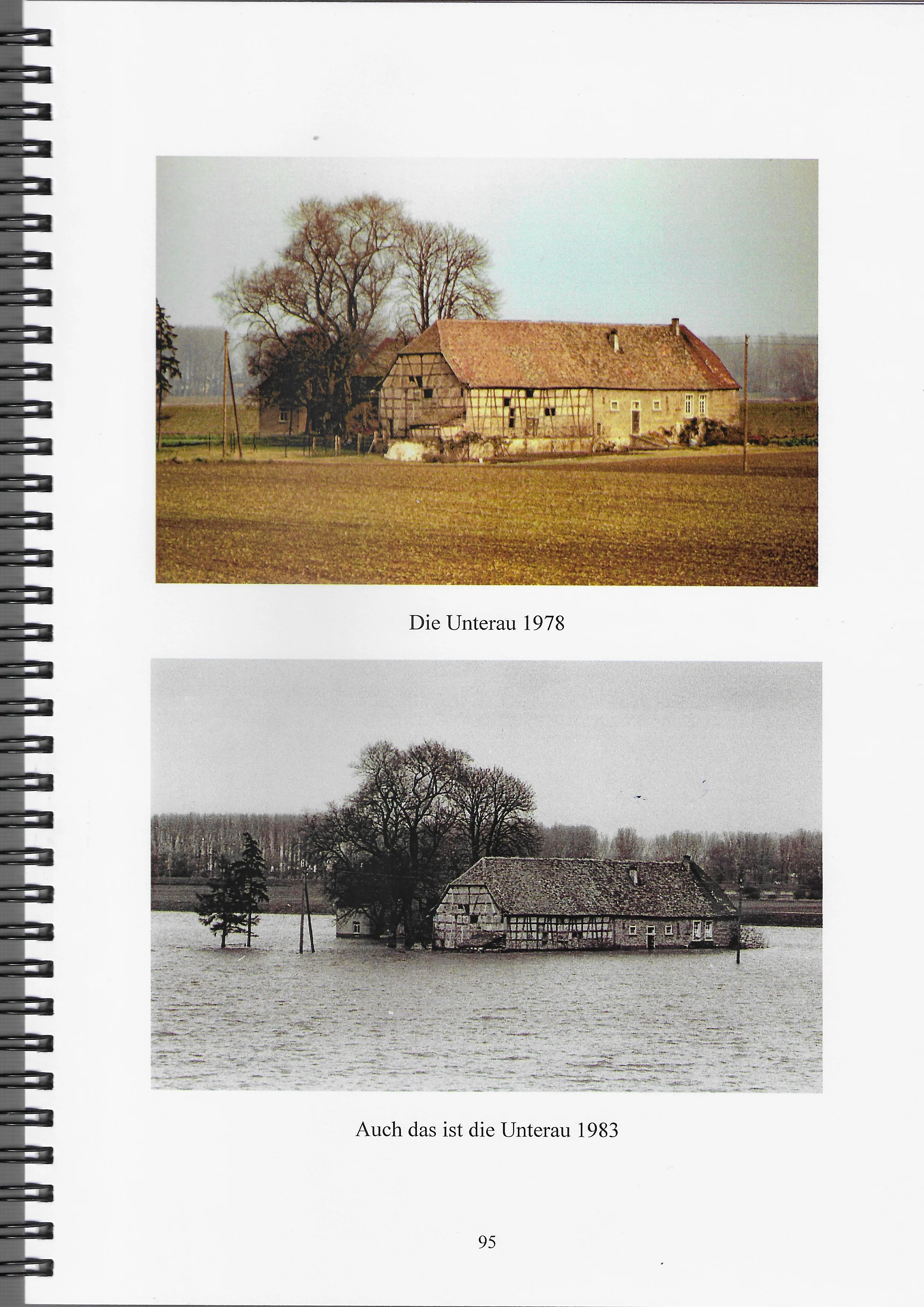
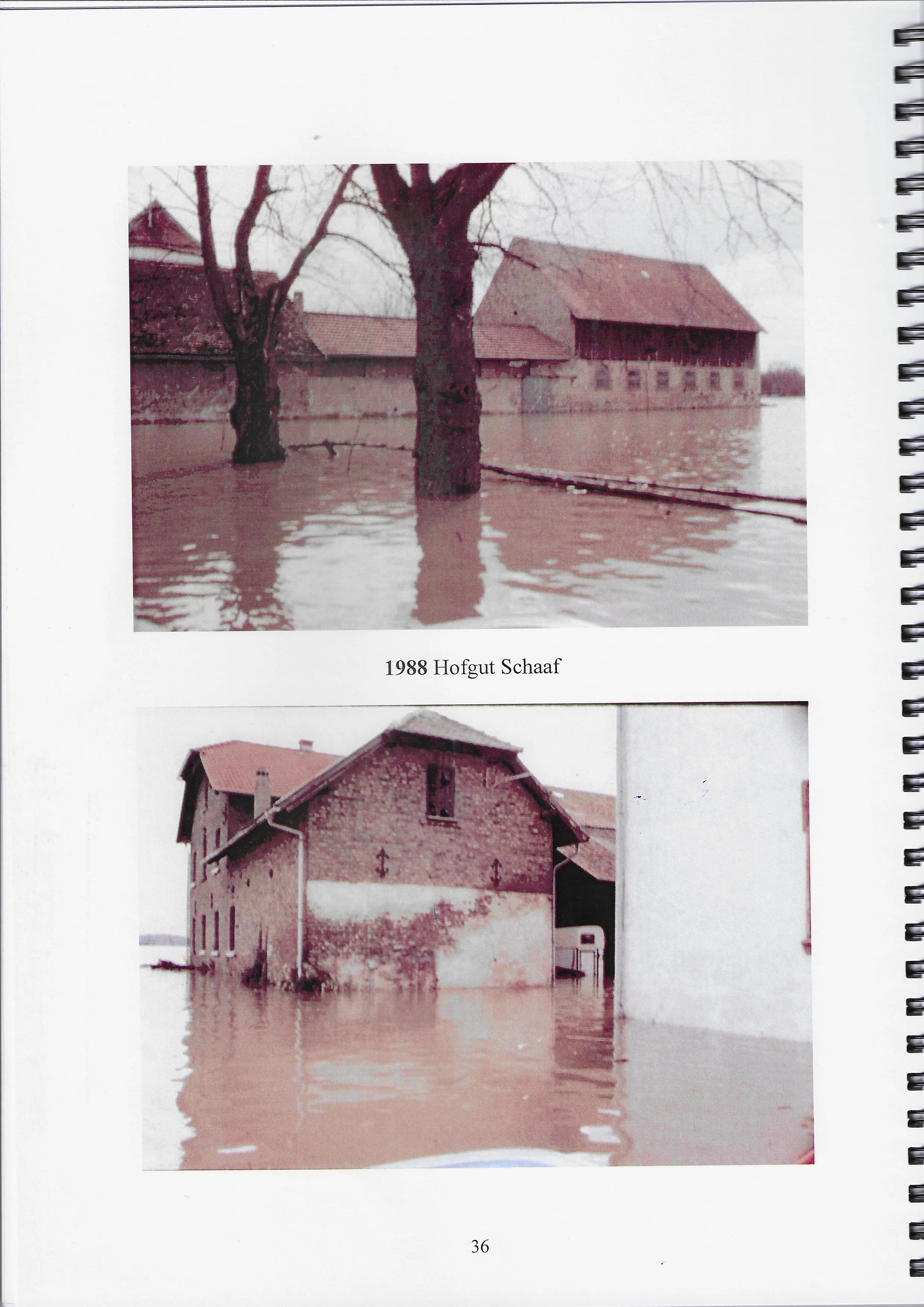
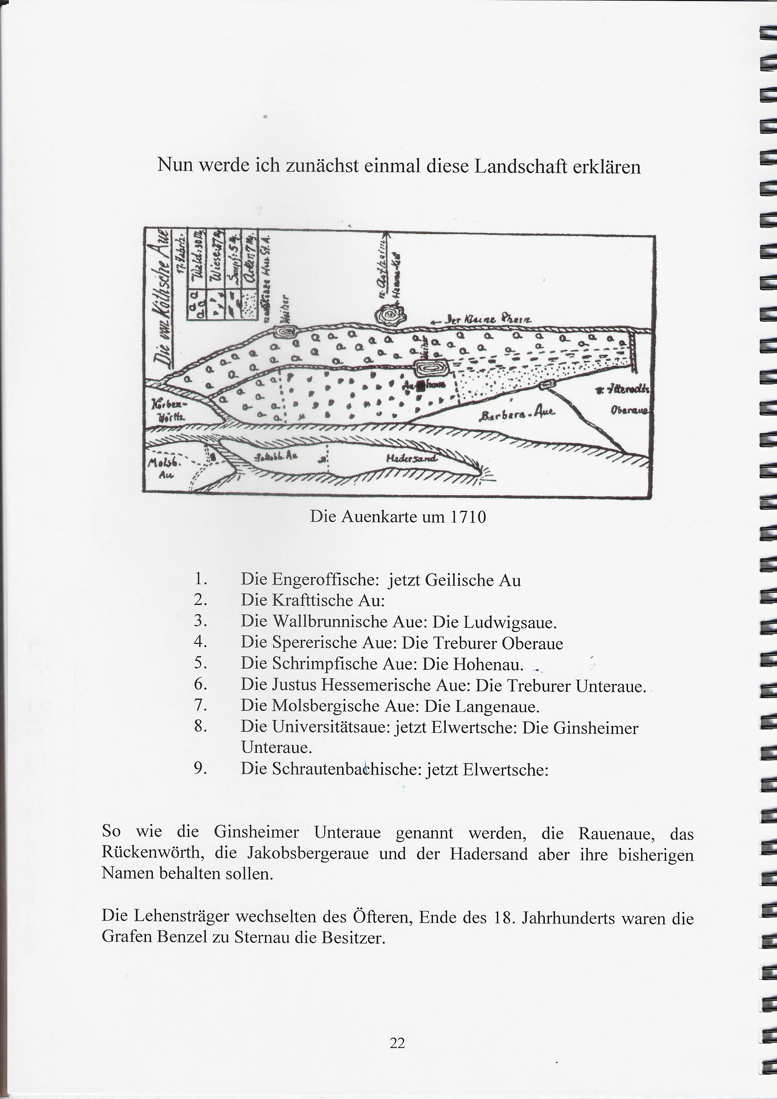
Source: local flood chronicle for the Ginsheim and Trebur reach of the Rhine. Pages reproduced as research material — CREDIT NEEDS THE PUBLICATION TITLE, AUTHOR AND YEAR BEFORE THIS GOES LIVE.